May 18, 1980: Mount St. Helens erupts, leaves a mess of documents
On this day in 1980, Mount St. Helens erupted in Washington on the Gifford Pinchot National Forest and left an altered landscape as well as a mess of historical documents in its wake. The deadliest volcanic event in U.S. history flattened 200 square miles of forest on the surrounding private and public lands. Its impact on forest management is still reverberating across the pages of history and forestry textbooks to this day.

Photo taken by Jim Hughes on May 18, 1980, of Mount St. Helens at about 3:30 pm. Hughes was about 20 air miles away. (U.S. Forest Service)
FHS has a plethora of documents and historical photos of the still-active volcano in different parts of our archive and library. In addition to numerous journals and magazines in our library with articles on the topic, the federal government (in particular the Forest Service) generated documents and reports on what happened before, during, and after the event. We also have materials on the ensuing debate over what it should do with its share of the land—whether the timber should be salvaged and the forest replanted or if it should be left alone and studied. Many of these items, along with oral history interviews with agency personnel, can be found in our U.S. Forest Service History Collection, which is searchable through our database. After much debate, which can be followed in the documents, the area managed by the Forest Service became a natural laboratory and a 110,000-acre national monument with two visitors centers (we even have information on those!).
Because that material isn’t yet online, here’s a blog post that summarizes what happened and its legacy. You can learn more about the impact of the eruption on the Forest Service’s land management practices in the film The Greatest Good and from a DVD extra, which you can see on our YouTube channel, as well as the companion book The Forest Service and The Greatest Good. We also have numerous photos in the FHS collection, like the one seen here of Mount St. Helens before it exploded, and the sample gallery at the bottom of this post.
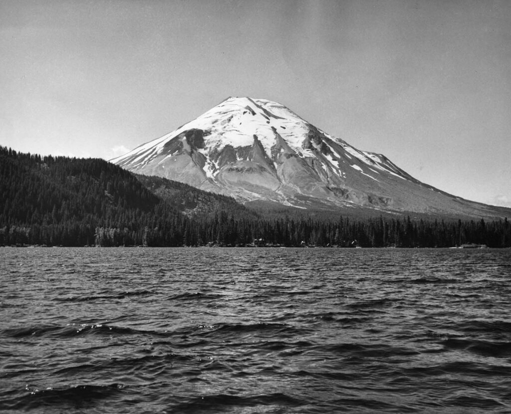
Mount St. Helens, photographed sometime in the 1940s or 1950s, probably from Spirit Lake. (FHS Photo Collection)
The Weyerhaeuser Company, which owned quite a bit of land adjacent to the volcano also impacted by the eruption, had to make similar decisions about what to do with its timberland. You can find two articles that touch on the company’s response to the eruption here and here, with “before” and “after” photos on page 26 of the second article. The company opted to actively manage their lands, conducting timber salvage and reforestation operations. There is a huge variety of materials in the Weyerhaeuser Company records collection at FHS.
Given the ongoing debates about whether the Forest Service land under study should be turned over to the National Park Service and reopened for recreation, it may be useful to revisit the history of Mount St. Helens and the legacy of the eruption.


