Routt National Forest
UNITED STATES DEPARTMENT OF AGRICULTURE
FOREST SERVICE
ROCKY MOUNTAIN REGION
DENVER, COLORADO
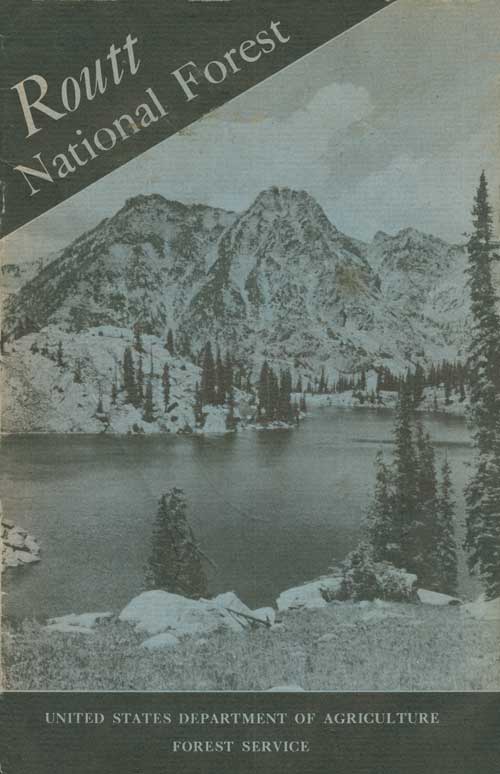
COVER PAGE.—Gilpin Lake and Big Agnes Mountain F—405394
UNITED STATES
GOVERNMENT PRINTING OFFICE
WASHINGTON:1941
Contents
In Ways of Greatest Service
When the Land Was New
How To Reach the Forest
Recreational Attractions
Picnicking and Camping
Hunting and Fishing
Riding and Hiking
Skiing
The Forest Resources
Timber
Water
Fish and Wildlife
Forage
Minerals
Fire Prevention
Flora of the Routt
Conifers
Broadleaf Trees and Shrubs
Ask the Forest Officers
Map of Routt National Forest (omitted from the online edition)
In Ways of Greatest Service
THE ROUTT NATIONAL FOREST, like other national forests of the United States, was established and is maintained for the purposes of preserving an adequate vegetative cover for regulation of stream flow and prevention of erosion, of growing timber to satisfy human needs, and of making the timber, water, and other forest resources available to the people of this country in ways of greatest service.
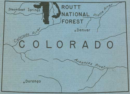
Located in northwestern Colorado on both slopes of the Continental Divide, this forest includes three distinctive chains of mountains. They are: The Park Range, which forms the Continental Divide; the Gore Range, a southern spur from the Divide branching off near Rabbit Ears Mountain; and the Elkhead Mountains, another spur extending westward from the Divide. In this vast area are some of the most beautiful and rugged peaks of the Rocky Mountain region.
When first established by proclamation of President Theodore Roosevelt, on June 12, 1905, the forest was called Park Range Forest Reserve. On July 1, 1908, the original name was changed to Routt, in honor of Col. John N. Routt, who was the last territorial and first elective governor of Colorado. Several additions and other changes have been made since the original proclamation. The net area of Government-owned land in the forest, as of June 30, 1940, was 984,226 acres.
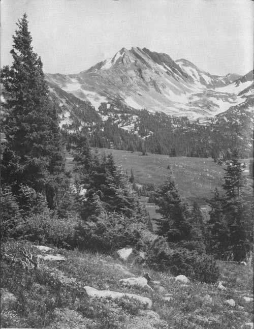
LOOKING TOWARD BIG AGNES MOUNTAIN F—364903
When the Land Was New
Early fur traders entered the present limits of the Routt many times, but the most interesting early explorations of that vast wilderness were those of Capt. John C. Fremont, in 1844, and Sir George Gore, in 1855.
Fremont, on his return from the Oregon-California expedition, traveled through the northwest corner of the State, crossing the present area of the Routt National Forest and the Continental Divide, to the North Platte River. There he decided to search for the headwaters of the Arkansas River, rather than return via Fort Laramie, and turned southward across Muddy Pass, to Middle Park. He crossed the Grand River, now the Colorado, and followed the valley of the Blue River to the pass which now bears his name, thence eastward by way of Pueblo.
Gore, a wealthy Irishman, for whom the Gore Range was named, went into North and Middle Parks with a large hunting outfit, guided by a noted scout, Jim Bridger. This party claimed to be the first white men to visit the springs at Steamboat, but this report is substantiated only by the lack of such a report by other explorers.
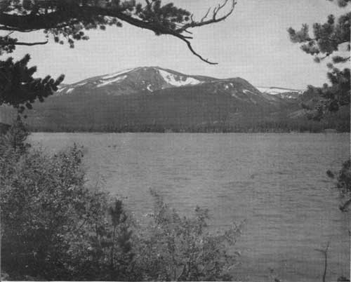
BIG CREEK LAKE AND RED ELEPHANT MOUNTAIN F—364901
How to Reach the Forest
BY MOTOR.—Modern highways provide safe, comfortable access to the Routt Forest from the North, South, East, and West. From the East one may follow U S 40 over Rabbit Ears Pass, take the Gore highway State Highway 84, over the Gore Range from Kremmling, or enter North Park via the Cameron Pass route, State Highway 14. Roads leading northward from Walden and Craig are connecting links with the Lincoln Highway, U S 30, in southern Wyoming. Motorists may reach the forest from the South by taking State Highway 11, a spur off U S 24, at Wolcott, then following State Highway 131 down the Yampa River from State Bridge to Steamboat Springs. U S 40 provides the main entrance for visitors from the West. Powerful snow plows keep this road open over Rabbit Ears and Muddy Passes throughout the winter.
BY RAIL.—A 7-hour daytime trip over the Denver & Salt Lake Railroad from Denver, via the 6.4-mile Moffat Tunnel, takes one to Yampa, Steamboat Springs, Hayden, or Craig, through some of the most beautiful mountain scenery in the Rockies. The construction of this railroad across the Continental Divide and onward to Craig, from 1905 to 1913, was a gigantic undertaking, and timber for railroad ties and other uses from the national-forest areas it traversed contributed greatly to the sucess of the venture. The Moffat Tunnel, which later replaced the 23-mile section of railroad over the divide, is a monument to David H. Moffat, who opened up the way to the great coal, timber, and ranching resources of the northwest corner of the State, including the Routt and other national forests. The story of his resourcefulness and courage in overcoming the many obstacles encountered is one of the most thrilling sagas of the development of the West.
BY TRAIL.—The Routt maintains a good system of trails, by which it is possible to travel by saddle horse or on foot to almost any point of the more wild and rugged areas.
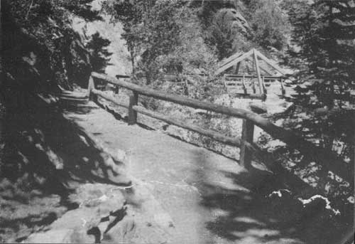
A GOOD TRAIL INTO THE HIGH COUNTRY F—405391
Recreational Attractions
Many and varied are the attractions open to the vacationist throughout the year on the Routt National Forest.
Picnicking and Camping.
Free camp and picnic grounds are maintained for the pleasure and convenience of the public at many places on the forest. All of the necessary facilities, such as fireplaces, tables, footbridges, and the usual sanitation improvements are provided. Deadwood is plentiful and handy at most of these sites and may be used freely but should not be wasted. Also, all users should protect the live trees and shrubs, and the campground improvements. The map in this booklet may be consulted for locations of individual grounds, descriptions of which follow:
BIG CREEK LAKES CAMPGROUND.—Leave State Highway 125 at Cowdrey and follow State Highway 312 to the junction with the Big Creek Lake Road, about a half mile southeast of Pearl. This road extends in a general southwesterly direction for a distance of 5 miles, to the north side of Big Creek Lake, where the campground is located. The lake offers a pleasant outing on the shores of the largest body of water within the forest. Red Elephant Mountain and Mount Zirkel loom up spectacularly across the lake. Camping, picnicking, fishing, swimming, boating, and hiking are the attractions.
FISH CREEK FALLS PICNIC GROUND.—Turn east off U S 40, near the eastern limits of the town of Steamboat Springs, and follow the Fish Creek Falls road about 3 miles, to the picnic ground and falls, at the end of the road. This is a delightful short drive for a picnic outing. Fish Creek Falls are especially beautiful early in the summer when they carry the largest flow of water from melting snows in the high mountains above.
RABBIT EARS PICNIC GROUND.—On U S 40 at Rabbit Ears Pass. Picnicking and a good view of the Rabbit Ears.
WALTON CREEK CAMPGROUND.—On southeast side of U S 40, about 4 miles west of Rabbit Ears Pass. Camping, picnicking, and fishing. The Walton Creek Campground is a very pleasant place for those who wish to stop a short time, to rest and refresh themselves from the weariness of travel.
COULTON CREEK CAMPGROUND.—From State Highway 129, take State Highway 311 at Clark, and drive east up the Elk River drainage about 4 miles, to the campground. Camping facilities are located on the south side of the road, on the north bank of Elk River at the junction with Coulton Creek. Picnicking, camping, and fishing.
HINMAN PARK CAMPGROUND.—Near State Highway 311, approximately 5 miles east of Clark. The camping improvements are on the south side of the highway. Turn off at the Hinman Park campground sign and follow a short drive to the camp site. Camping, picnicking, and fishing.
SEEDHOUSE CAMPGROUND.—Follow east on State Highway 311 from Clark about 8 miles to the bridge across Elk River. The campground is on the south side of the highway one-quarter-mile east of the bridge. It is a spacious recreation area, favored by those who have some time to spend on the forest and wish to enjoy privacy. Camping, picnicking, fishing, and hiking are the main attractions. From this location one can drive a car to Slavonia and hike into the high country along the Continental Divide to the head of the Elk River and return in a day. Many spectacular mountain peaks and lakes await those who make this trip. The hike from Seedhouse Campground by trail to Three Island Lake is also a very nice 1-day trip.
LAKE FISHING ON THE ROUTT IS GOOD F—155891
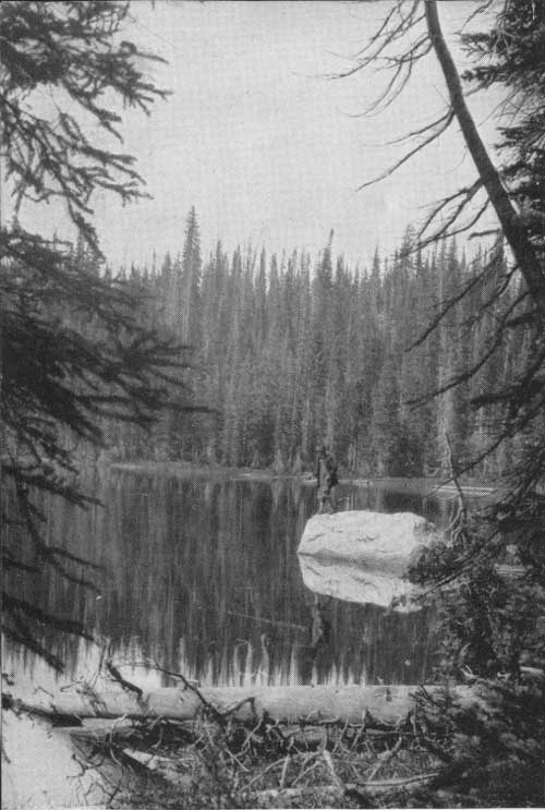
Hunting and Fishing.
Trout fishing is very good in many of the crystal clear streams and lakes of the forest. With the exception of occasional temporary closures, all the streams and lakes are open to fishing. Young fish, varying in size from fry to legal size, are obtained from State and Federal hatcheries each year and placed in the more heavily fished waters to keep them well stocked.
There is an abundance of game animals on the Routt, and hunters are reasonably sure of success. Most of the elk range in the country west of the Continental Divide, between Elk River and Walton Creek watersheds, and deer are found generally over the forest. All hunting and fishing is under the jurisdiction of the State Fish and Game Commission, and State game laws apply on the forest, the same as on other lands.
Riding and Hiking.
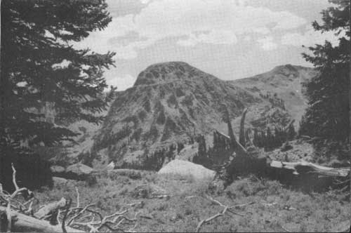
Hundreds of miles of well marked trails afford rich opportunities to the nature lover for exploration of remote parts of the forest. A pack trip into the Mount Zirkel-Dome Peak wild area takes one into the most scenic part of the forest, where conditions are nearly as primitive as they were when Indians hunted in these beautiful mountains or camped beside the picturesque lakes. Red Elephant Mountain, Big Agnes, The Dome, Mount Zirkel, Flat Top Mountain, and Lost Ranger Peak are some of the more prominent points on this area. Under the present Forest Service plan, the area will be maintained in its original wild and primitive state except for the occasional trails that traverse it. Refer to the map for the location of this wild area.
Resorts and dude ranches within and adjacent to the forest have saddle horses to rent and will provide guides if this service is desired. Information regarding the locations of these places may be obtained from the commercial clubs or chambers of commerce in the local towns.
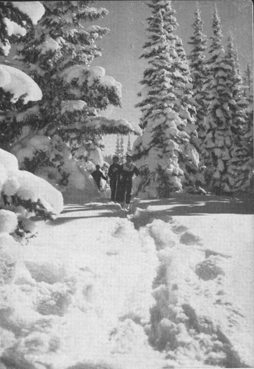
SKIERS ON THE TRAIL TO RABBIT EARS PASS F—405397
Skiing.
The Rabbit Ears Pass area of the forest, with natural conditions of heavy snowfall, long winter season, and a great variety of favorable open and timbered slopes, attracts many ski enthusiasts.
There are practice hills for the beginner, natural slalom areas and ski runs for the more advanced, and longer routes for cross-country skiers. U S 40 passes through this winter wonderland and is maintained in good condition during the entire season. Adequate parking space is kept clear of snow.
The Valley View Ski Run is probably the most popular run of the area. It takes off on the north side of U S 40, about a half mile west of the Rabbit Ears Station, and comes back to U S 40 at Valley View Lodge. This route is approximately 3-1/2 miles in length. The first mile, starting at the top, is nearly level, then drops 2,000 feet in the remaining 2-1/2 miles. The lower mile provides the choice of a first-class run of considerable interest for experts or a slower and longer route for less-experienced skiers. This range of interest, combined with the many attractive views of the surrounding high timbered country and the broad Yampa River valley below, make it a very attractive run.
Skiers who prefer cross-country skiing over longer distances may take the trip from Rabbit Ears Pass to the Buffalo Pass Station, and thence west along the old Buffalo Pass Road to Steamboat Springs. However, a guide should be obtained for the trip, unless one is familiar with the country.
Ski tournaments are held at Howelsen Hill, in Steamboat Springs, each winter. The improvements, consisting of jumps, a tow, slalom, and downhill runs, are owned and maintained by the Steamboat Springs Winter Sports Club. Good food and lodging accommodations are available in Steamboat Springs, conveniently located to the Rabbit Ears Pass area.
FOREST HEALTH RULES
1. PURIFICATION.—Mountain streams will not purify themselves in a few hundred feet. Boil or chlorinate all suspected water.
2. GARBAGE.—Burn all paper, old clothing, or rubbish. Bury or place in pits or receptacles provided, all garbage, tin cans, bottles, and other refuse.
3. WASHING.—Do not wash soiled clothing or utensils or bathe in springs, streams, or lakes. Use a container and throw dirty water where it cannot get into the water supply without first filtering through the ground.
4. SANITARY PRECAUTIONS.—Use public toilets if they are available. Where not provided, bury 1 foot deep all human excrement, at least 200 feet from water.
5. OBEYING LAWS.—Observe the rules of sanitation and protect yourself and others. Report all insanitary conditions to the nearest health or forest officer.
The Forest Resources
Timber.
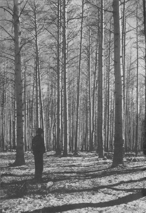
Extensive stands of saw timber on the Routt aggregate over 2,300,000,000 feet, board measure. Lodgepole pine is the most important species, with Engelmann spruce running a close second. Alpine and Douglas fir make up the remainder of the commercially important timber.
Timber is raised and harvested on the forest as a crop, much the same as a farmer grows vegetables or grain, the main difference being in the length of time it takes to produce the two types of crops. The mature, overcrowded, and defective trees are selected and designated for cutting by trained foresters in advance of the logging operations. Such trees have ceased to make good growth and their removal promotes faster development of the younger and more healthy trees that remain. The volume of the annual timber harvest averaged 7,810,000 board feet during the 5-year period ending June 30, 1940. This is much less than the annual growth, and many times that amount may be cut each year in the future without depleting the total stand of timber. As a matter of fact, the timber growth on the forest will steadily increase as the present mature and decadent stands are replaced by more thrifty rapid-growing trees.
Logging operations, to harvest national-forest timber, are carried on under the supervision of forest officers. The timber is sold to private individuals who cut it in accordance with plans prepared by forest officers. Competitive bids are solicited by the Government for all of the larger sales of timber, and award is made to the highest qualified bidder. The money from such sales, and from grazing and other uses of the forest, is paid into the national treasury, but 25 percent is returned to the counties in which the forest is located, in lieu of taxes, to be used for either school or road purposes.
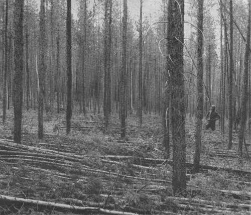
THINNINGS IN A CROWDED LODGEPOLE STAND F—365878
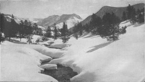
DEEP SNOWS, THE RESERVE SUPPLY OP IRRIGATION WATER F—174433
Water.
Irrigation is the key to most of the agriculture of the West. Water for irrigation in turn is dependent largely on the snows and rains which fall at the headwaters of the various creeks and rivers. The maintenance of an adequate forest cover in the high mountain ranges results in slow melting of the heavy snows and provides for a continuous and uniform supply of water during the growing season for the thirsting agricultural crops in the broad fertile valleys below.
The Yampa River valley, which is one of the best ranching valleys in the State, is irrigated with water from the Routt National Forest. Other agricultural sections benefited by water from the forest are the valleys of the Colorado, North Platte, and Little Snake Rivers, whose waters originate in part in the Routt.
Fish and Wildlife
An attempt is made to maintain an abundance of fish and animal life on the forest by regulation of fishing and hunting. Streams and lakes are stocked regularly with fish from the Federal and State hatcheries, open seasons are adjusted, and certain waters are closed over short periods to maintain a plentiful supply for all who delight in angling for trout.
Big-game animals, such as elk and deer, are hunted during limited seasons, set by State law. Adequate range is reserved for them on the forest, the same as for domestic stock. Game uses the grazing resources in areas too rugged for cattle and sheep. Forest officers assist the State in law enforcement and other wildlife activities.
The more common species of wild animals of the Routt are:
ELK OR WAPITI (Cervus canadensis).—Wapiti is the Shawnee Indian name for elk. They are the largest local representatives of the deer family, the bulls weighing from 700 to 1,000 pounds. They have widely branching antlers, large light-colored rump patches, with sides and backs of a yellowish to brownish gray, dark-brown legs, neck and head, and blackish under parts. The cows are without antlers and are generally less strongly marked. Elk are polygamus and in the fall, or mating season, the "bugle" challenge of the bulls leads to fierce fights. The spotted calves, usually one, but sometimes two or three, are born in May or June. During the summer, about 1,200 head graze annually along the Continental Divide on the Routt, moving to range near Steamboat Springs in winter.
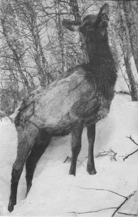
ELK ON WINTER RANGE F—405399
ROCKY MOUNTAIN MULE DEER (Odocoileus hemonius).—These are the common deer of the western ranges and are so named on account of the large ears. They are extensively hunted during the established season. The bucks have antlers with pronged tines which are shed annually after the mating season. The color in summer ranges from tawny to yellowish-brown and they have a medium-sized white tail with a black tip. The under parts are darker or blackish. In winter the color changes to a dark gray. The average weight of the bucks ranges from 150 to 200 pounds. Their bounding gait is characteristic. Mating occurs in late fall, and the spotted fawns, usually two, are born in late May or June. They are found at all elevations, and according to latest estimates, there are approximately 2,200 head on the Routt. Most of them drift to the lower country outside the forest for winter range.
BEAVER (Castor canadensis).—Beavers are large, aquatic rodents, compact, heavy bodied, and powerfully muscled. The broad, flat, scaly tail is characteristic, and, contrary to common belief, it is not used as a trowel. The pelage is composed of long, hard hair, with a short, soft underfur. Hearing and sense of smell are keen, but eyesight is poor. Mature animals weigh from 60 to 70 pounds. They are perhaps best known for the picturesque houses and dams they build in small streams. Material for houses and dams is clutched, against the body by the forefeet used as hands. The fur is highly prized, and the beaver itself is of considerable value because of the water which it stores in ponds by means of dams. The food consists of bark from aspens, willows, and cottonwoods, and roots of some grasses and aquatic plants. Beaver are plentiful on most portions of the Routt.
COYOTE (Canis lalrans).—The coyote is a small, slender species of wolf, 42 to 48 inches long, weighing from 35 to 40 pounds. The pelage is fairly long and heavy and is a grizzled, huffy, grayish and black, with under parts whitish. These animals are cautious and clever, and instead of retreating before human occupation, they merely change their habits and remain. They are prolific, and litters of from 5 to 7 pups are born about April. The shrill staccato howl of the coyote is familiar to everyone who has been in the West. The poultry and sheep depredations of coyotes have resulted in relentless persecution of the species by man. They inhabit all parts of the Routt.
BEAR (Euarctos americanus).—Contrary to popular belief, black and brown bear are of the same species, the color varying from black to cinnamon brown. The average height is 25 inches, and the weight varies from 200 to 500 pounds. They are monogamous, mating in June and early July. From 1 to 4, but usually 2 cubs, weighing from 8 to 18 ounces, are born in January or February, during hibernation. Hearing and smelling powers of the species are highly developed, but sight is poor. The skin and head are much prized as trophies and the flesh is edible. The bear population of the Routt is estimated at 650; the animals are found on nearly all portions of the forest.
ROCKY MOUNTAIN BIGHORN SHEEP (Ovis canadensis).—The bighorn is stoutly built, with medium or short legs, small pointed ears, and a short pointed tail. The pelage is hairy, not woolly. The rams, weighing from 200 to 300 pounds, have massive permanent horns with curl back, out, and around. The females have small, slightly curved horns. The animals have upper parts of grayish brown, with paler sides, creamy-white rump patches, and under parts of yellowish white. They are polygamous and mate in November and December. The lambs, sometimes 2, but more often 1, are born in May or June. The sense of sight is very keen and hearing also is well developed. In the past, relentless hunting has driven the bighorns from their former range in the lower foothills to the higher, steeper, and more rugged mountains, and even though protected from hunting by law they have been decreasing during the past decade. It is estimated that there are now approximately 50 on the Routt.
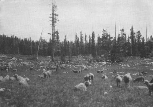
SHEEP ON THE FOREST RANGE F—212967
Forage.
About 12,000 cattle and 115,000 sheep, owned by 190 stockmen, are grazed on this forest annually, under permits issued by the Government. A small fee is paid by the permittee for each head grazed. Forest officers carefully supervise this use to prevent damage to the forest cover and to maintain maximum forage production.
Generally sheep use the higher and more rugged areas, while the lower and more accessible country is allotted to cattle. The sheep are grazed in bands of about 1,000 head each, and are kept under the direct control of a herder. Cattle do not naturally graze in bands, as do sheep. Cowboys ride the cattle ranges, put out salt at suitable locations, and keep the animals well scattered.
The country surrounding the Routt Forest has many productive livestock ranches. Their owners raise large quantities of hay to feed stock through the winter, but often need the forest range for summer pasture, to provide well-rounded ranch operations.
Minerals.
Placer gold was discovered at the base of Hahns Peak in 1862, by Joseph Hahn and two companions. Forced to recross the Continental Divide before winter, Hahn was unable to return to his discovery until 1865. That year he found considerable gold, returned to Georgetown and Empire, outfitted a party of 50 men and returned in 1866 to Poverty Bar, as Hahns Peak was originally named. When the party left in the fall, Hahn and two other men, named Doyle and Way, did not go. Way later went out for provisions and did not return. Hahn and Doyle lived through the winter on rabbits. Finally, in an attempt to reach the settlements, Hahn succumbed to illness and starvation, and died on the banks of Muddy Creek, May 30, 1867. His remains were buried later near the spot, about 1 mile from the present town of Kremmling. Hahns Peak, 10,824 feet in elevation, commemorates the name of this early prospector.
Prospecting and mining were continued in this vicinity on a limited scale at a later date, but the total production was less than half a million dollars. No other precious metals in sufficient quantities to be of commercial importance have ever been found on the Routt.
The Forest Service encourages legitimate mining developments within the national forests. No restrictions are placed on prospecting, and the general mining laws apply to operations on forest lands in the same manner as to those on other public lands. National forest timber on a mineral claim may be used without charge for the development of the claim.
Fire Prevention
Fire is the worst enemy of our forests. It destroys the wild animals, the timber, shrubs, and flowers in its path, and even robs the soil of fertil elements. Removal of the protective surface cover by fire paves the way for subsequent heavy soil losses as the rains fall and roll down steep, charred slopes unchecked. Trout streams soon become fouled with muddy waters and the trout leave.
But with care, fire can be largely eliminated in the timber. Practically all of the larger burned-over areas on the Routt date back some 60 years to the carelessness of man before the national forests were established. In those early days, when a fire started no effort was made to put it out unless it endangered a settlement. Since the forest has been under Government control, this toll of destruction from fires has been much reduced. Cooperation by the public in promptly reporting fires to the nearest forest officer or fire warden and quick attack by organized fire-control crews, under the direction of experienced forest officers, keeps fires from reaching large proportions.
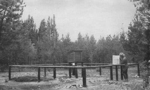
STATION FOR MEASURING FIRE DANGER IN THE FORESTS F—365826
Fire records kept on the Routt since 1909 show that 213 fires have burned over 2,122 acres of forested land, an average of only 66 acres per year, during the 32-year period. Eighty percent of this land was national forest, the remainder private or State-owned. Of the total, 168, or 78 percent of the fires, resulted from man's carelessness. Practice the rules for fire prevention given on the map attached to this booklet and help keep our forests green.
Flora of the Routt
Myriads of colorful wild flowers turn the high mountain meadows into beautifully blended carpets after the heavy winter snows have receded before the summer sun. They include a great many species. Among the more common are daisies, paintbrushes, buttercups, violets, asters, lupines, larkspurs, bluebells, columbines, geraniums, and sunflowers. Space does not permit of descriptions for the flowers in this publication. For those interested, there are many good books which describe and illustrate the flowers of the Rocky Mountains.
Conifers.
Most of the trees on the Routt are conifers. They are known to many people simply as "pines," but really include pines, spruces, firs, and junipers.
PINES.—The pines have their needles gathered together at the base in bundles of from two to five. The cones are woody and pendent.
LIMBER PINE (Pinus flexilis).—Needles are fine, almost silky, dark green, 1-1/2, to 3 inches long, always in bundles of five. Cones are 3 to 10 inches long, with seeds one-third inch long; scales smooth. Bark is light gray or silvery white, except on old trunks, which are blackish brown, and furrowed.
PONDEROSA PINE (Pinus ponderosa).—Needles are 4 to 7 inches long, deep green; usually grow three in a bundle but sometimes two, and in tufts at the ends of the branches. Cones are 3 to 6 inches long and scales are armed with spines. When young, the bark is dark and the tree is, often called "blackjack" or "bull" pine. When older, the bark is yellowish in thick scales.
LODGEPOLE PINE (Pinus contorla).—Needles are 2 to 3 inches long, yellow green, growing in bundles of two; bark thin; cones one-sided, 1-1/2 to 2 inches long, and cling to the branches for years without opening or dropping their seeds. Cone scales are armed with short spines. This species is used mostly for railroad ties, mine props, and telephone poles.
SPRUCES.—Needles are scattered over the twigs singly; sharp-pointed, four-sided, leaving twigs rough like a grater when they fall off. Cones are pendent, with parchmentlike scales, falling off the tree whole.
ENGELMANN SPRUCE (Picea engelmannii).—The new-growth twigs are covered with soft, short hair. Needles are less rigid and less sharply pointed than those of blue spruce, green, dark blue, or pale, steel blue. Cones are 1 to 2 inches long. Bark is dark, reddish brown, and separates in the form of small rounded scales. Main trunk, in contrast to blue spruce, is smooth and clean.
BLUE SPRUCE (Picea pungens).—The new-growth twigs are always smooth. Needles are stiff, with sharp points, varying in color from silvery blue to green. Cones are from 2-1/2 to 5 inches long, averaging twice the length of Engelmann spruce cones. Bark of mature trunks is gray and deeply furrowed. The main trunk always has numerous short twigs pushing out between branches.
ALPINE FIR (Abies lasiocarpa).—Blunt, flat leaves, about 1 to 1-3/4 inches long, without any stem where they join branches. Soft to the touch and fragrant. Needles tend to turn upward. Cones 2-1/2 to 4 inches long, dark purple, and unlike those of other species, stand erect. In autumn the cones fall to pieces and leave only the central stalk on the branch. Bark smooth, grayish white, becoming furrowed in mature trees. Blisters containing liquid pitch or balsam found on smoother bark. Tree has a sharp spirelike crown. Usually found mixed with Engelmann spruce at the higher altitudes.
DOUGLAS-FIR (Pseudotsuga taxifolia).—Although similar in name, this species has no direct relationship to the true fir. Its leaves are flat, 3/4 to 1-1/2 inches long, with short stems that join them to the branches. Cones are pendent, with three-pronged bracts protruding from the cone scales; they are persistent and fall off the tree whole. Buds are sharp-pointed, shiny, smooth, red brown.
JUNIPERS.—The fruit is berrylike, bluish in color. The needles are merely small, green scales, attached closely to the twigs, though sometimes spreading and about one-half inch long, making twigs very prickly to the touch. The trees are usually found with pinon and oak.
ROCKY MOUNTAIN JUNIPER (Juniperus scopulorum).—The berries are about the size of peas, the bark is scaly, the twigs are slender and graceful, and the heartwood is red. The berry usually has two seeds and is bluish or black. The berries mature in 2 years.
UTAH JUNIPER (Junperus utahensis).—Berries one-fourth to one-third inch long. Bark ashy gray, about one-fourth inch thick, broken into long thin scales. Wood light brown, with nearly white sapwood. Berries are reddish brown, have one or rarely two seeds, and mature in 2 years. A small bushy tree, rarely over 20 feet high.
A BEAUTIFUL GROVE OF ASPEN ON THE ROUTT F—405398
DOME PEAK, WITHIN THE PRIMITIVE AREA F—405390
Broadleaf trees and shrubs.
ASPEN (Populus tremuloides).—The flat, nearly heart-shaped leaves are about 2 inches across; they tremble characteristically in a breeze. The bark is whitish, or very pale green, smooth, with black scars where branches have dropped off. They rarely grow more than 60 feet high.
NARROWLEAF COTTONWOOD (Populus angustifolia).—This is usually a tall tree, 40 to 60 feet high. The bark is dark gray, heavily ridged half or two-thirds of the way up the tree; above that, smooth, pale green. The leaves are one-half to 1 inch wide, by 2 or 3 inches long, very similar to willow leaves. The species is usually found along streams at lower elevations.
ROCKY MOUNTAIN MAPLE (Acer glabrum).—Usually a shrub, but frequently 20 to 30 feet high. This species has paired, opposite buds, sharply lobed leaves, light-gray bark, and paired, winged seed. Its leaves are 1 to 2 inches long, opposite each other.
SCRUB OAK (Quercus sp.).—Usually a shrub, rarely more than 15 feet high. Leaves are alternate, smaller at the base than at the ends, with deep lobes; frequently drying on the tree and remaining over winter. The fruit is a short, pointed acorn. The species forms dense thickets at lower elevations. Often valuable for fence posts.
THINLEAF ALDER (Alnus tenuifolia).—The alder grows along and over hanging streams, usually in clumps, several trees from the same root, frequently 4 to 6 inches in diameter and 15 to 25 feet high. Its leaves are large and sharply double-toothed. The mature, seed-bearing fruit is cone-like and quite noticeable in winter.
WILLOWS (Salix sp.).—This is the common shrub of creek bottoms. Its leaves are usually narrow, sharp-pointed. Some willows attain a diameter of 4 inches and a height of 15 to 25 feet. The buds are covered by a single scale.
WESTERN CHOKE CHERRY (Prunus demissa).—This is a shrub 3 to 15 feet high. Flowers and fruit are clustered. Alternate leaves are sharply pointed. Bark, seed, and leaves are bitter to the taste. Fruit is black.
PACIFIC SERVICEBERRY (Amelanchier florida).—Leaves silvery, sharply toothed above the middle and alternate on branches. Trees, or more often shrubs, 6 to 15 feet high. Flowers white and in clusters. Five hard seeds in each berry. Berries edible, nearly black when ripe.
Ask the Forest Officers
Officers of the Forest Service will gladly answer any inquiries regarding recreational trips, the resources of the forest, or the everyday work of foresters. Information may be obtained from any of the forest officers at the addresses given below:
Forest ranger, North Park District, Walden, Colo.
Forest ranger, Gore District, Steamboat Springs, Colo.
Forest ranger, Hahns Peak District, Steamboat Springs, Colo.
Forest ranger, Bears Ears District, Hayden, Colo.
Forest supervisor, Steamboat Springs, Colo.